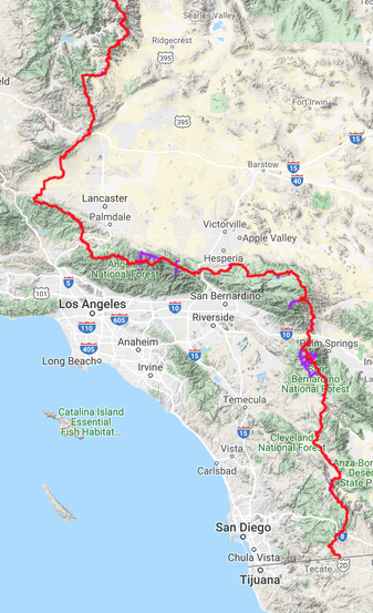
The Plan: Section A
From the Mexican Border to Highway 178
USEFUL RESOURCES:
- Forest Service site for Cleveland National Forest PCT Information
- The PCT Association Website section on the southern section of the PCT
- https://www.pcta.org/discover-the-trail/geography/southern-california/
- Mexico border North to Lake Morena
- https://www.fs.usda.gov/recarea/cleveland/recreation/hiking/recarea/?recid=47566
- Boulder Oaks Campground
- https://www.fs.usda.gov/recarea/cleveland/recarea/?recid=47412
- http://www.californiasbestcamping.com/anza_borrego/boulder_oaks.html
- https://www.hipcamp.com/california/cleveland/boulder-oaks-campground
- Boulder Oaks Campground reservations (necessary for horse sites)https://www.recreation.gov/camping/campgrounds/231948
- Houser Canyon resourses
- https://www.alltrails.com/trail/us/california/hauser-canyon-trail
- https://www.sandiegoreader.com/news/2007/jan/18/remote-hauser-canyon-between-lake-morena-and-campo/#
- Cottonwood Creek Bridge Trail from Lake Morena
- https://www.fs.usda.gov/recarea/cleveland/recreation/hiking/recarea/?recid=47568
- https://www.fs.usda.gov/recarea/cleveland/recreation/hiking/recarea/?recid=47568
- Kitchen Creek Southbound to Kitchen Creek falls
- https://www.fs.usda.gov/recarea/cleveland/recreation/hiking/recarea/?recid=47570
- https://www.fs.usda.gov/recarea/cleveland/recreation/hiking/recarea/?recid=47570
- Fred Canyon to Kitchen Creek
- https://www.fs.usda.gov/recarea/cleveland/recreation/hiking/recarea/?recid=47490
- https://www.fs.usda.gov/recarea/cleveland/recreation/hiking/recarea/?recid=47490
- Storm Canyon to Kwaaymii
- https://www.fs.usda.gov/recarea/cleveland/recreation/hiking/recarea/?recid=47490
- https://www.fs.usda.gov/recarea/cleveland/recreation/hiking/recarea/?recid=47490
